
Potomac Heritage Trail Crew
By Robert Shutler, Pete Neal, and Glenn Tobin
We admire our brothers and sisters who maintain the trails of the Shenandoah and Tuscarora, but sometimes the Potomac Appalachian looks like the Cadillac/Hoodlums Newsletter. We are here to tell you that there are indeed other chapters. The Potomac Heritage Trail (PHT) Chapter maintains the delightful ten-mile trail that parallels the Potomac between Teddy Roosevelt Island and the American Legion Bridge.
Our stretch is dense with history. Native American settlements date back at least 5000 years. Captain John Smith noted in his journal that as his crew was taking on fresh water from a tributary at the base of the (Great) falls (probably Pimmet Run), natives pelted them with stones.
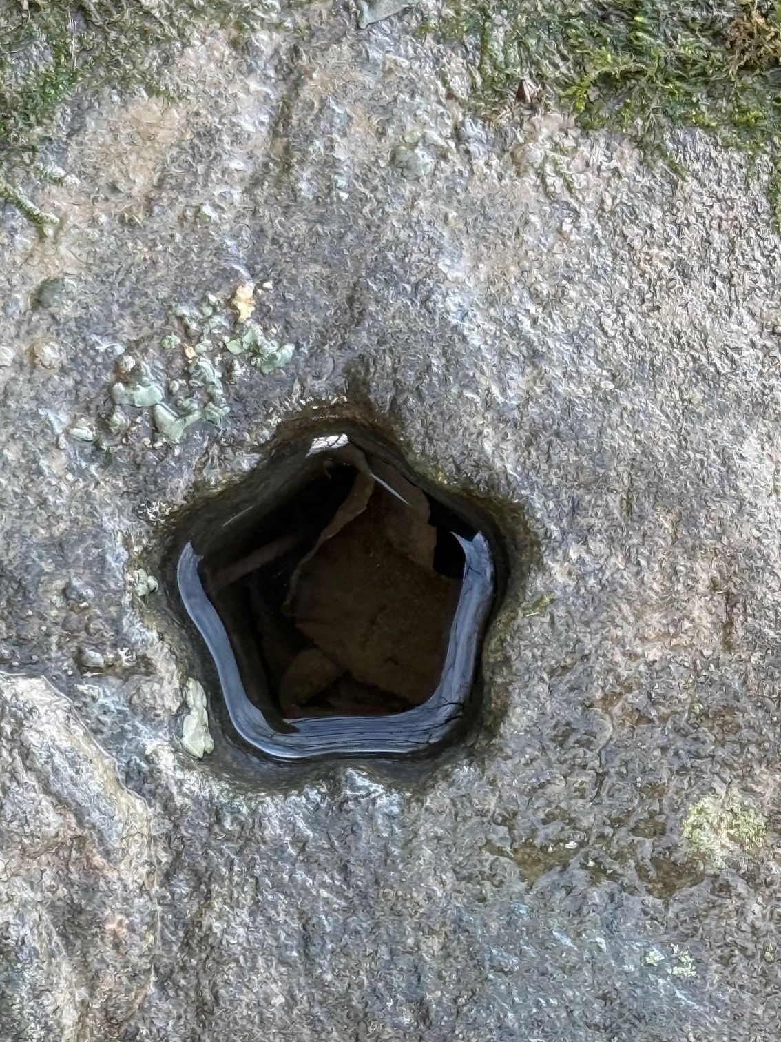
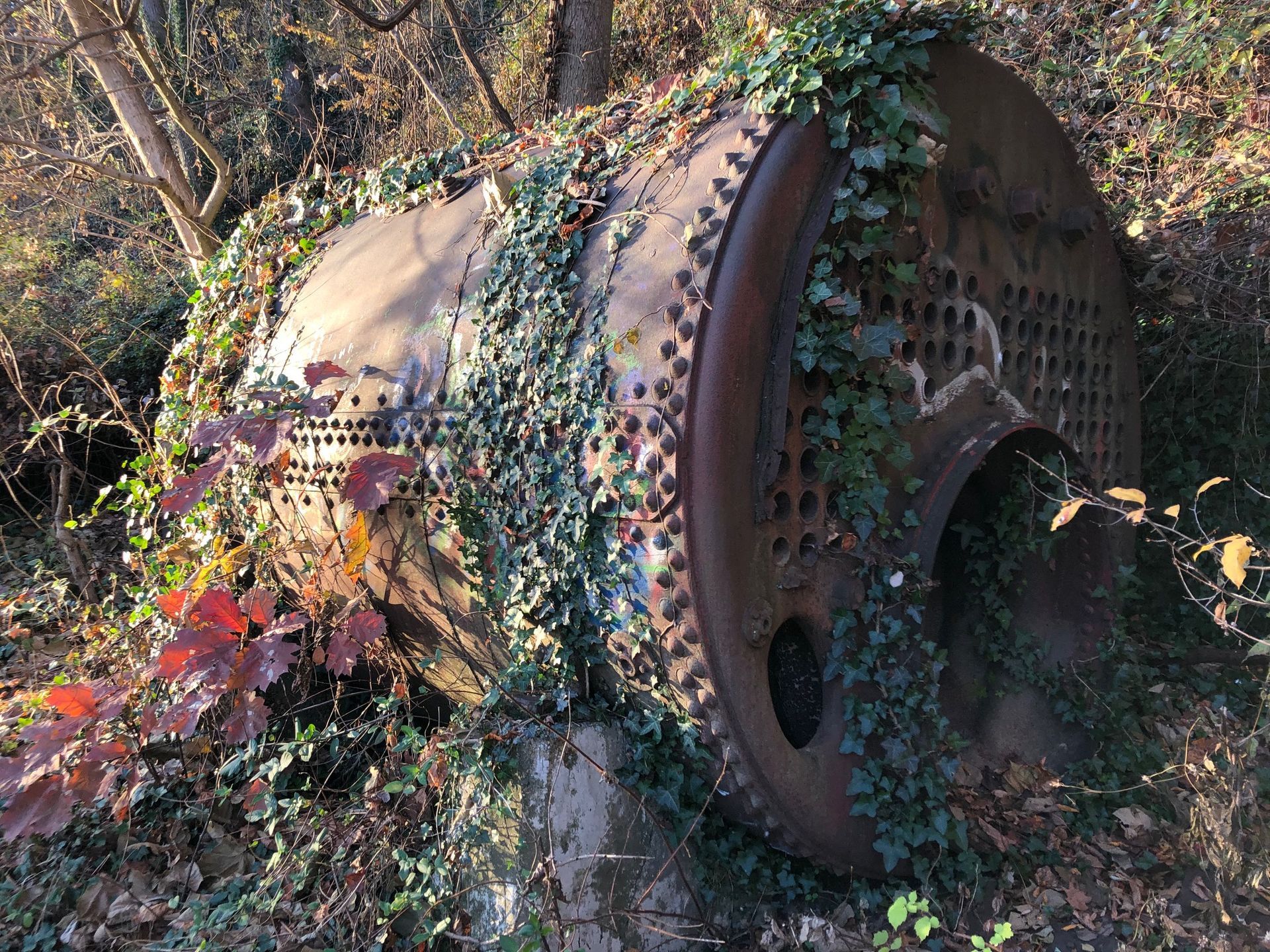
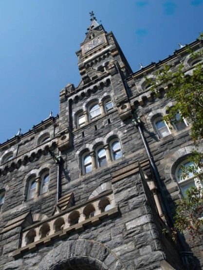
Going back a bit further, the stone that lines the Potomac Gorge is metamorphic (including metagraywackes-- love that name) and was formed about 750 million years ago. It is particularly useful in building since it breaks in a rectilinear way. Between 1830s and 1930s much of D.C.'s building foundations and roadbeds were made of it. Check out Georgetown University's Healy Hall, for example. The quarries from which it was extracted line the southern bank like giant crescent scoops. Evidence can be seen in the ruins of buildings and several abandoned boiler tanks that ran the steam operations. The photos show two holes cut into the stone for blasting. The six-point hole reveals that it was chiseled by hand, the round hole by steam drill.
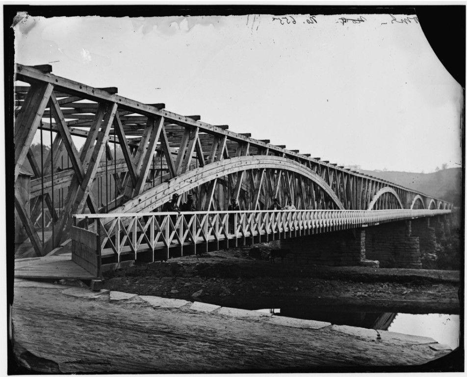
Right in the middle of the PHT is Chain Bridge. That is Chain Bridge number eight. All previous spans were swept away by floods. Bridge number three used chains made of 4-foot iron links; the name stuck.
During the Civil War, the bridge was considered so important in the defense of Washington that three forts were built to protect it. One of those, Fort Marcy, is where the very first military aerial reconnaissance occurred. From a hydrogen balloon, Union forces were able to direct fire on the city of Falls Church, a Rebel stronghold at the time.
In 1930, both sides of the Potomac were designated a National Park, all the way to Cumberland, Md., with the C&O Canal on the north and the PHT on the south.
At the same time, work on the George Washington Memorial Parkway began, linking Mount Vernon to the new Memorial Bridge. It was the first federally funded parkway to incorporate divided lanes, limited access, and clover leaf intersections; it became the model for modern roadway design.
The Parkway was continued in the 1960s and by 1970 it linked to the Beltway bridge crossing the Potomac, known at the time as Cabin John (believed to be a contraction of Captain John, as in Captain John Smith). In 1969 it was renamed the American Legion Bridge. The designers of the Parkway (which included Frederick Law Olmstead, Jr) were careful to keep it on top of the bluff to maximize views, back when driving was a leisure activity. This allowed a wide swath of land for a delightful towpath at water's edge.
There are no less than five waterfalls. Wildlife uses the Potomac corridor as a highway - deer, beaver, even bears. The fall line, division between tidewater and piedmont, occurs at Great Falls, just upriver from Chain Bridge. As a result, we get all the brackish water fish as well as the freshwater fish and the accompanying waterfowl. With as many as 430 species of birds, there are plenty of opportunities for birding.
Our duties include rebuilding stone stairways, cutting water channels, removing blowdowns, trash collection, and managing invasives. There are times we consider ourselves the Kudzu Krew. Kudzu, much to our chagrin, was intentionally planted as erosion control along the GW Parkway.
<<Previous Article Back Home Next Article