
Buzzard Rock to Veach Gap Trail
By Josh Silverman
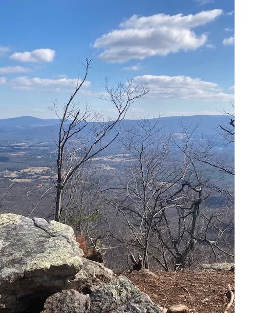
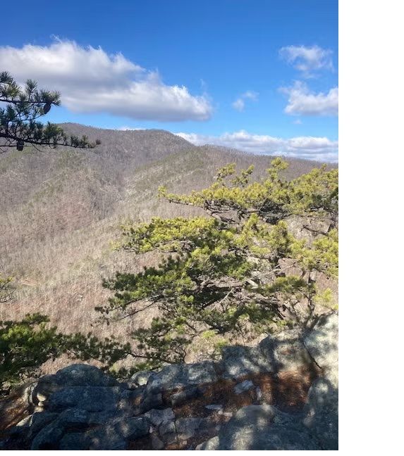
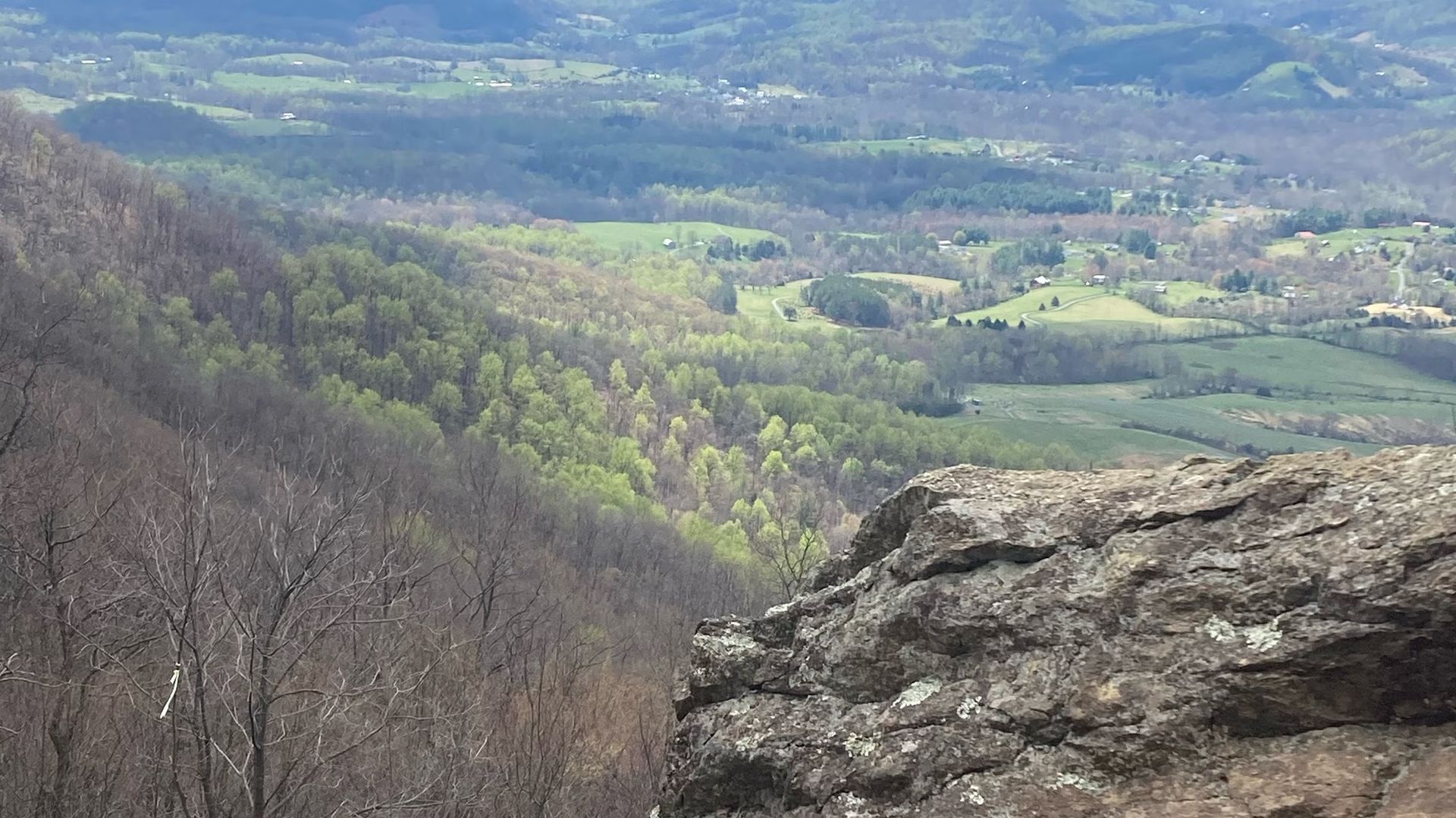
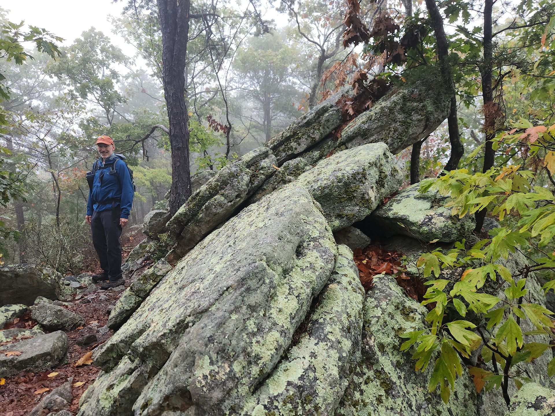
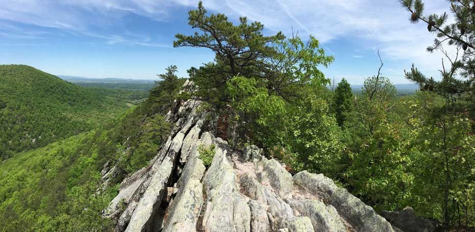
Photos: Views Along Buzzard Rock by Annetta DePompa and Tim Muzzio
Here is a challenging, 10.5 miles hike, with 2400’ elevation gain with spectacular views.
The hike includes several views of the Passage Creek Gorge in Fort Valley to the west and Page Valley and the Blue Ridge to the east. This is a one-way hike, so cars will be needed both at the beginning and the end of the hike. Start the hike early as both parking areas tend to fill up quickly in fair weather, and the parking area for the Veach Gap trail is not very large. Coordinates for the Buzzard Rock parking area on VA-619, Mountain Road, are 38.93775,-78.28861 and the Veach Gap parking area on Rte. 774, Veach Gap Road, 38.87613,-78.37785.
Begin the hike from the Buzzard Rock parking area. From the Buzzard Rock trailhead, follow the white-blazed trail for 1.5 miles as it ascends to the saw-toothed, east ridge of Massanutten Mountain. The slope is gentle at first but becomes steeper as it bends to the left and approaches the ridge. At the north end of the ridge is a view of the ponds of the Fish Cultural Station and the northern Shenandoah Valley. Along the ridge itself the trail becomes narrow and requires stepping up and down on rocks and squeezing between them, with narrow footing on very steep slopes.
Proceed along the ridge for 0.5 miles to a viewpoint along the sharply tilted rocks to the right, looking 700 feet down into Passage Creek Gorge. Across the gorge is the Buzzard Rock Overlook on the Massanutten Trail. Continue along various peaks and sags (ascents and descents are steep and rocky here). The trail becomes broader and less rocky as it approaches the Front Royal Overlook to the left in 0.8 miles. After an additional 0.6 miles, the Buzzard Rock Trail reaches its highest point and then descends gently for 0.6 miles. It ends at the junction of the orange-blazed Massanutten Trail, the blue-blazed Tuscarora Trail, and the yellow-blazed Shawl Gap Trail. The total distance on the Buzzard Rock Trail is just under four miles. Take the second left to go south on the Massanutten Trail/Tuscarora Trail.
The trail soon begins a steep ascent up a sidehill with stone steps and a steep drop-off with a very rocky tread. After 0.4 miles it reaches the ridge again and continues with various peaks and sags, for 1.75 miles to Sherman Gap.
The pink-blazed Sherman Gap Trail makes a T-intersection with the Massanutten Trail coming in from the right and then resumes its divergent path to the left in another 0.15 miles.
After the Sherman Gap diverges from the Massanutten/Tuscarora Trail, continue ascending for 0.2 miles and follow the trail over the twisting ridge where the Massanutten and Little Crease Mountains join. After an additional 0.7 miles the trail comes to The Point Overlook, with a magnificent view of Page Valley and the Blue Ridge. Several bends of the oxbows of the South Fork of the Shenandoah River can be seen. Depending on the starting time of the hike, this viewpoint is a good place to have lunch.
After leaving the overlook, in 0.2 miles the trail descends nearly 1000 feet on switchbacks to the drainage area between the Massanutten and Little Crease Mountains. Use caution, for portions of this descent are extremely rocky. Continue for 0.4 miles to a left turn at the head of Mill Run.
At this point the trail becomes significantly flatter and less rocky. Continue for 1.8 miles to the intersection with the Veach Gap Trail coming in from the right. The total distance on the Massanutten/Tuscarora Trail is slightly over 5.5 miles.
Turn right onto the yellow-blazed Veach Gap Trail. This delightful trail crosses Mill Run in about 0.2 miles (use caution—the rocks can get slippery here) and passes through the beautiful Veach Gap, a water gap in Little Crease Mountain. Go past a turnoff to the right 0.2 miles past the stream crossing and a second turnoff after 0.1 mile; both of these lead to private property. Continue on the trail to the Veach Gap parking area. The total distance on Veach Gap Trail is slightly under 1.2 miles.