
Learning the Avenza Maps App in the Classroom and on the Trail
Article by Jeff Monroe, photos by Marit Anderson
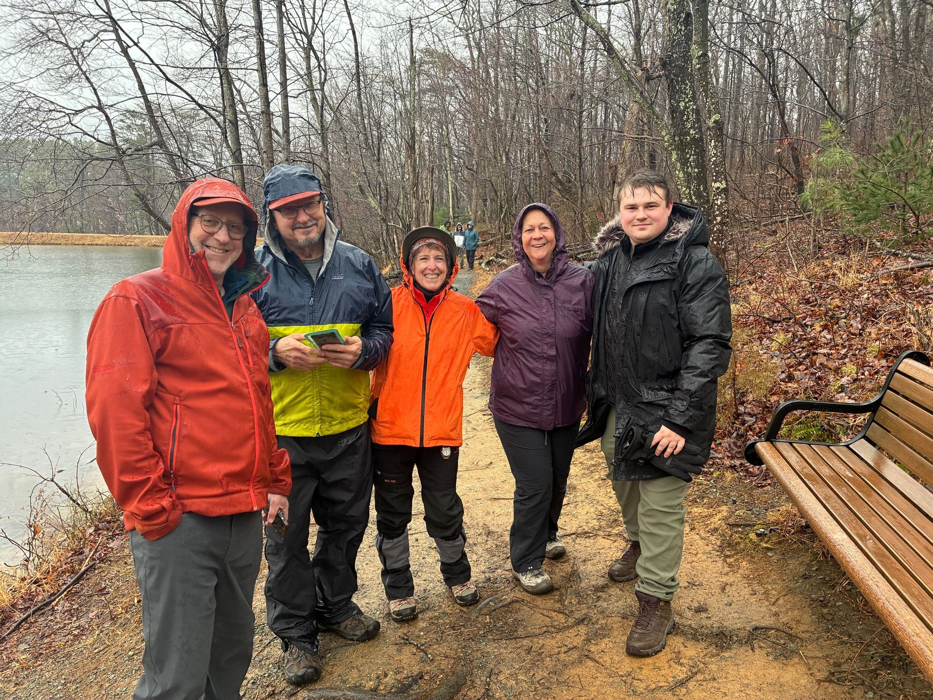

With the recent introduction of PATC’s Shenandoah map updates on the Avenza app, a number of members in the Charlottesville and Southern Shenandoah Valley Chapters requested a class covering Avenza use on the trail. January is a good time to do this, so 16 PATC members met at the Crozet (Virginia) Library on Saturday, January 10 to learn more about how to use Avenza and how it differs from other mapping apps used by hikers.
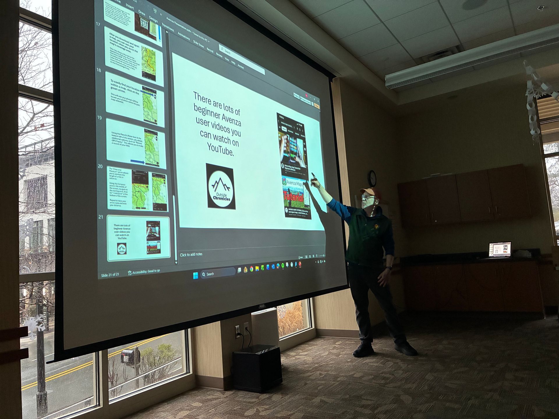
The library session also compared Avenza to the hiking app Gaia GPS and why the class leader insists that Gaia is superior to the widely used AllTrails app. Hosting and teaching the class was Jeff Monroe, Hikes Committee member and co-chair of the PATC’s GIS Committee responsible for updating PATC trail maps and preparing them for uploading to the Avenza store.
After the library portion, many of the attendees reconvened at a nearby county park and field tested their knowledge of Avenza’s capabilities, using a free map of the park downloaded to participants’ smartphones from the Avenza map store.
Avenza now publishes electronic versions of all three of PATC’s Shenandoah National Park (SNP) trail maps, allowing users who have purchased those maps to determine their exact location while on the trail in an area covered by those maps. Monroe recounted how he uses these maps extensively on Avenza while volunteering for PATC’s Trail Patrol within the SNP boundaries. Screenshots document the location of trail issues that merit further action by other PATC volunteers.
Of particular interest to the attendees:
- The Avenza app comes in both a free and a paid version, but almost everyone can use the free version without restrictions. The paid version is most important to the small percentage of users who upload a lot of their own maps to the app.
- Like other hiking/mapping apps, Avenza can be used on phones even when there is no cell service. The GPS functionality of current cellphones does not require connectivity to work and inform the user of current location. Simply download the required map in advance.
- Avenza’s store is much broader than just hiking maps. Monroe recounted his use of both Avenza and Gaia GPS when touring Florence and Rome last year because the Avenza library included great free tourist maps of each city that could be uploaded in advance.
- One of the disappointing aspects of Avenza is the occasional difficulty in locating maps available in a predetermined area. Searching for “Shenandoah National Park,” for example, should give priority to maps of the national park, but in practice, maps outside of the park were the first ones that came up during a recent search. Maps should be listed in order of distance from the search term.
- Avenza does allow users in the Avenza Store to search by the age of the map, allowing everyone to realize just how old the National Geographic maps are compared with PATC maps–just one of many superior aspects of PATC maps!
- Avenza maps can be updated in between print runs. Recent trail construction in the PATC’s Entry Run district adjoining the SNP Central District (not found on any print maps) can be added to the Avenza version of Map 10 even though that map will not be reprinted for several years. Users are notified of map updates, which are included in the purchase price.
- Avenza and Gaia GPS have different strengths and can be used in conjunction with each other. Monroe recounted his personal experience in Florence, Italy switching between each app. Avenza’s store included a free tourist map that was downloaded in advance and used often, while Gaia GPS allows for adding different types of waypoints in advance to its map, so the tourist can map their own critical locations before traveling, such as the train station, hotel, recommended restaurants, museums, historic sites, and even–in Florence–the famous “Wine Windows” where tourists can purchase a glass of wine to go!
- He also discussed his use of Gaia GPS while on Spain’s Camino Primitivo in 2024. Downloading previous pilgrims’ public tracks to Gaia meant that he was never lost and always had other users’ routes to review along the way, limiting the stress of an insufficient command of the Spanish language.
- AllTrails routes are not nearly as reliable as other sources because AllTrails attracts newer hikers and the data uploaded is often of questionable quality. The discussion included this quote found online, “More than once, using both apps, I’ve found Gaia was on track while AllTrails wanted us to be 100 yards away in the middle of underbrush.”
- Monroe added that his premium Gaia subscription allows access to a layer indicating private property ownership, which is essential for off-trail explorations in the national forest.
Following 90 minutes of class time, many of the participants headed out to a nearby park for hands-on experience. Because of rain, the class convened under a covered picnic pavilion to practice creating waypoints and adding information and photos to the waypoints. When the rain temporarily subsided, the class practiced tracking their route. A trip to Crozet Pizza (once named “Best in the World” by National Geographic) completed the day, where the group discussed the possibility of a follow-up class in the future covering how to upload waypoint details to Gaia similar to the Monroe’s Camino experience.
Editor’s Note about GPS Map Apps
My friends and I have had good success with AllTrails. David Caviness said, “A few years ago I used Gaia and I found it more difficult to draw my own routes and there was no reviews or comments on a particular trail or route. AllTrails has that and drawing was much easier so I went back to AllTrails.” Routes on Gaia or AllTrails can be off, but you don’t follow the route into the brush. You stay on the trail. Of course, routes derived from actual tracks are most accurate. — RS