Blog Layout

Breaking Barriers: Christine Reed on her Upcoming Book Blood Sweat Tears

Emily Rehr • Mar 19, 2024

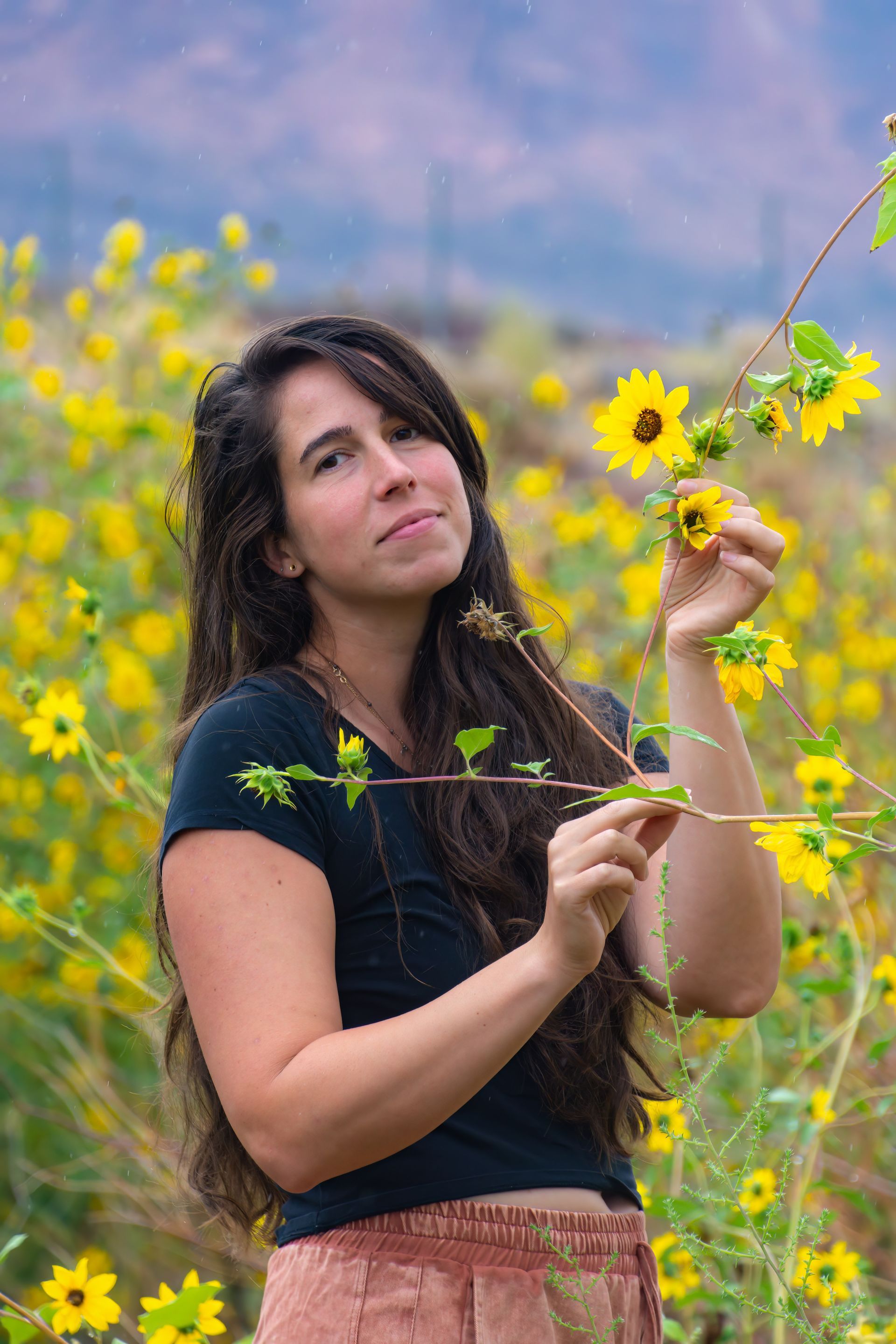
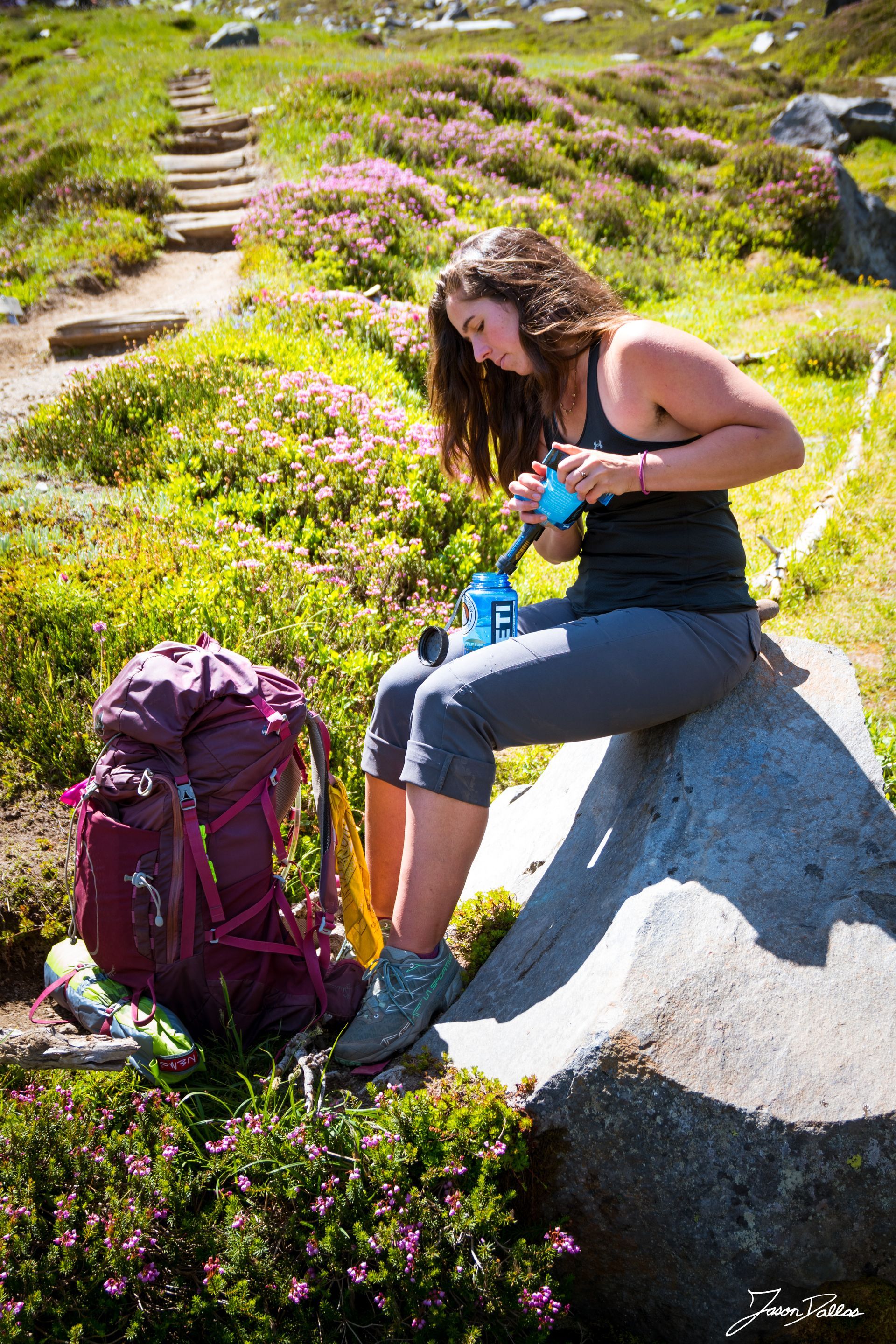
In the world of outdoor sports and literature, the voices of women have often been sidelined or overlooked. However, Christine Reed emerges as a beacon of inspiration, challenging stereotypes and breaking barriers with her work.


Christine is a long-distance backpacker and the author of the highly acclaimed memoir,
Alone in Wonderland. She offers a raw and unfiltered perspective on women's experiences in the wilderness. In a recent interview with the Potomac Appalachian Trail Club, she discussed the process of collecting stories and perspectives for her second upcoming book Blood Sweat Tears, alongside speaking about being a woman in the outdoors space. 


Christine's journey in outdoor spaces as a woman with POTS has been one of resilience and self-discovery. Despite struggling with her body for years and feeling like she was always "out of shape," she persevered and pushed herself to the limits. However, it wasn't until her diagnosis with POTS/dysautonomia in 2020 that she realized her struggles were not her fault. 


Instead of battling against her body, she learned to tune in and listen to its needs, leading to newfound limits and heights in her outdoor adventures.  Instead of pushing through the pain Christine now focuses on asking “what does my body need?”  This has allowed her to “find new limits, new distances, new heights—because the body is far more capable when it is cared for.”


The narratives in
Blood Sweat Tears contribute significantly to the broader conversation about women's experiences in the outdoors, particularly addressing the taboo topic of menstruation. Christine noticed a lack of discussion around periods in outdoor adventure memoirs and sought to change that with her book. By sharing stories of managing the female body in outdoor spaces, she aims to normalize these conversations and empower women to embrace their truths fully.


One of the most resonant aspects of
Blood Sweat Tears is its inclusivity and diversity of experiences. Christine curated a collection of stories that span a variety of female experiences, from motherhood and infertility to reproductive health challenges.  She states that the “power of representation in storytelling cannot be overstated— when we see people we can relate to doing things we don’t think we can do, we start to see the possibility we once didn’t believe in.” 


Through sharing these stories, Christine has created something truly special that all women can deeply connect with, highlighting the universal themes of resilience and strength.


For aspiring female writers who may feel intimidated by the traditionally male-dominated outdoor literary space, Christine offers valuable advice: your story matters. She encourages women to reach out to others for support and guidance, emphasizing the importance of representation in storytelling. Not only is she sharing her own story, but she's also creating a platform for others to do the same. 


With
Blood Sweat Tears, she is launching Rugged Outdoorswoman Publishing, which aims to amplify the narratives of women and gender expansive individuals in outdoor spaces. If you have a story to share, you can submit your manuscript and join the movement to elevate women's voices in the wilderness.


In terms of the outdoor community's evolution towards inclusivity and representation for women, Christine acknowledges progress but also recognizes the work that still needs to be done. She hopes to contribute to this movement through her book and future endeavors, striving for true equality and transparency.


Looking forward, Christine envisions a future where women's voices are elevated without shame or secrecy. She hopes to see more space made available for women's stories in outdoor sports and literature, fostering a culture of empowerment and solidarity.


As readers engage with the stories in
Blood Sweat Tears, they are invited to connect with the universal theme of the relationship to their body. Christine reminds us that despite our differences, we share common thoughts and ideas about our bodies, making these stories deeply personal and relatable.


Christine Reed's journey and her upcoming book
Blood Sweat Tears not only challenge societal norms but also pave the way for a more inclusive and empowering narrative surrounding women in the outdoors. Through her courage, resilience, and dedication, Christine inspires us to embrace our bodies and experiences fully, breaking barriers one story at a time.


Pre-order
Blood Sweat Tears through Rugged Outdoorswoman (releasing May 1st) and check out Christine’s sneak peak preview on her blog.


Follow Christine and her adventures on
Instagram, Facebook, and Linkedin.


By Ruth Walkup 15 Apr, 2024
Virginia Black Bear Festival Announcement What: Virginia Black Bear Festival When: June 1, 2024 from 10am – 4pm Where: Downtown Stanardsville, VA Cost: Free! On June 1 st , Stanardsville will host the Virginia Black Bear Festival on National Black Bear Day. Various organizations that honor nature, promote outside activities and adventures, and celebrate the emergence of black bears will be on hand to celebrate the Shenandoah National Park, the Appalachian Trail, and Virginia’s wild spaces. All things BEARS will be going on, from led-hikes and professional storytellers, to bear- and honey-themed food from area food trucks, appearances by Sasquatch and Smokey the Bear, BEARd and porridge-eating competition, live music, and opportunities to watch demonstrations (a master falconer and a pro-bird watcher will be present, as will a live bee display) or learn a new skill (fly-fishing or archery, anyone? And there’s so much more. The PATC, a partner in the festival, will host an information table and will lead several local hikes. Members of the PATC Southern Shenandoah Valley and Charlottesville chapters will be present. Come join us! The final schedule and a map will be published May first, but in the meantime, look to www.vablackbearfestival.org .
By Wayne Limberg 13 Apr, 2024
Keep Calm and Read On: A Life Outside A his 60th birthday neared, Virginia Senator Tim Kaine decided it was time to make good on a promise he had made to himself years earlier: hike all 559 miles of the AT in VA, bike the Blue Ridge Parkway's 321 miles and paddle the James River's 348. From 2019 to 2021 he did just that, keeping a daily journal on each trip. The result is “Walk, Ride, Paddle: A Life Outside.” Kaine's love for the outdoors dates to his days in Boy Scouts and family camping trips in Missouri, a passion that continued through his college years at University of Missouri and Harvard Law. Even after he moved to Richmond and began his political career, he found time for hiking, biking and paddling both at home and abroad. Trips with family and friends more often than not had an outdoor element. In deciding to embark on “Virginia Nature Triathlon,” he realized he was upping the ante. As he notes in the book, some of his congressional colleagues thought he had lost it. Undeterred, he set out, patching together days and weeks to fit his busy official schedule. Walk, Ride, Paddle: A Life Outside is the work of a storyteller with a keen eye for nature and human foibles. A proud Virginian, he is quick to point out the Commonwealth's natural beauty and history. PATC members will recognize a good deal. One of Kaine’s favorite hikes is the AT south of Thornton Gap. He is also quick to credit those responsible for making his triathlon possible with shout outs to park rangers, PATC trail maintainers, and others he encountered. Along the way, readers find out the senator has a thing about spiders and a taste for bourbon. One of the book's joys is the author's ever-present optimism and self-deprecating humor and humility; his trail name became Dogbowl. It's a long story. The Roller Coaster on the AT in Northern Virginia or a badly burned foot on the James did not stop him but they did make him think twice about the wisdom of his decision—and in the case of the Roller Coaster, come up with some songs to take his mind off the aching knees and record heat. Another strength of the book is Kaine's readiness to share his inner thoughts, often through lines of poetry from the likes of Roethke and Whitman. Despite its subtitle, Walk, Ride, Paddle: A Life Outside is as much about a life inside as outside. A self-confessed introvert, Kaine values time alone. His triathlon became something of an extended meditation as he sought to recharge his batteries and re-examine his life and values, in the wake of the bruising 2016 presidential race. A practicing Catholic, he turned to his faith, most importantly the ethos of service, self-examination and discernment instilled by the Jesuits when he was in high school and when he took a year off from law school to work with Jesuit missionaries in Honduras. He also looked to other faith traditions. One of his favorite pieces of advice comes from George Fox, the founder of Quakerism, "Walk cheerfully over the earth, answering that of God in everyone.” Early on, Kaine promises that Walk, Ride, Paddle: A Life Outside is not going to be about politics. That's a bit, however, like trying to write a book about the Titanic without mentioning ice. As he left Harpers Ferry, the impeachment process was starting. 2020 saw the global pandemic and Kaine's own COVID experiences. His paddle of the James came just months after January 6. Some will look at the calendar and argue that it was no coincidence that Walk, Ride, Paddle: A Life Outside appeared on the eve of Kaine's 2024 re-election bid but this is one of those times to heed Teddy Roosevelt’s advice that those not in the arena are best ignored. Kaine does not dwell on politics but neither does he ignore them, offering insights into most of the salient events that coincided with his travels. He proudly identifies as a progressive Democrat, invoking the Old Testament prophet Micah's injunction to do kindness, seek justice and walk humbly. One of his heroes is his father-in-law, Linwood Holton, the first Republican governor of Virginia since the Civil War. Kaine credits his election as re-establishing a two-party system in Virginia and for his support for de-segregation even though he knew it could cost him his political career. At end of the book, Kaine admits that over the intervening three years he has regained some of the 26 pounds he lost on the trail. Looking back, he sees his experiences as grounding, not humbling. To the degree that Walk, Ride, Paddle: A Life Outside was response to his turning 60, readers can only hope to get so lucky when he turns 70. Do you have a good read you would like to recommend or review? Send it along to wplimberg@aol.com . Meanwhile, keep calm and read on. See you on the trail. 
By Emily Rehr 12 Mar, 2024
Hiking is a great way to connect with nature, admire beautiful landscapes, and challenge ourselves physically and mentally. However, hikers often face obstacles that can make their journey difficult. One of the obstacles that can make hiking tricky is a blowdown. A blowdown is when a tree or a big branch falls across a trail. While a blowdown might not seem like a big deal, it's actually quite important for trail maintenance and your overall hiking experience. What Is A Blowdown? Blowdowns can occur due to various reasons, including strong winds, heavy snowfall, and natural decay. They can pose hazards to hikers, blocking paths and creating obstacles that require careful navigation. Blowdowns can disrupt ecosystems, affecting habitats and changing the landscape. Therefore, it's important for hikers to understand the significance of addressing blowdowns and contributing to trail care efforts. Maintaining trails is essential for preserving hiking routes and ensuring the safety of outdoor enthusiasts. When blowdowns obstruct paths, hikers tend to walk around or leave the established trails. This disrupts the vegetation in the surrounding area, as people trample over flora and create more wear and tear on the environment. Fallen trees and branches can create tripping hazards, especially in areas with dense vegetation or uneven terrain, which can increase the risk of getting lost or injured. By clearing blowdowns and keeping trails clear, hikers can enhance their safety and enjoy a better outdoor experience. Addressing blowdowns is also crucial for promoting environmental stewardship and preserving natural landscapes. Fallen trees can hinder the growth of vegetation, disrupt ecosystems, and affect the biodiversity of the area. Additionally, blowdowns can obstruct waterways and contribute to soil erosion, causing further ecological damage. By promptly addressing blowdowns and maintaining trails, hikers can minimize their environmental impact and contribute to the conservation of natural habitats. Why We Should Care About Trail Maintenance Trail care is a collective responsibility that involves hikers, outdoor enthusiasts, and conservation organizations. Volunteer groups such as the Potomac Appalachian Trail Club, play a crucial role in addressing blowdowns and ensuring the accessibility of hiking routes. PATC organizes regular clean-up events where volunteers work together to remove debris, clear trails, and mitigate environmental damage caused by blowdowns. By volunteering for PATC and involving themselves in trail maintenance activities, hikers can actively contribute to the preservation of wilderness areas and foster a sense of community among outdoor enthusiasts. Hikers can also practice responsible outdoor ethics to minimize their impact on trails and natural environments. This includes staying on designated trails, avoiding cutting switchbacks, and respecting wildlife and vegetation. By following these principles, hikers can reduce the likelihood of blowdowns occurring and help maintain the integrity of hiking routes for future generations. Encountering blowdowns during a hike can be a common hurdle, but it's something that we can all help with. These obstacles can have a significant impact on the environment and the trails we love to hike on. By taking part in trail maintenance and being mindful of the impact we have on the environment, we can help preserve the natural beauty of the landscapes we enjoy so much. Let's work together to ensure that hiking routes remain safe and accessible for all, while also protecting the wilderness for future generations to experience and cherish. Want to help maintain our trails? Volunteer with PATC! Check out our Volunteer Page to learn more.
By Jennifer Schmid 05 Mar, 2024
Photo of Jennifer Schmid
By Emily Rehr 27 Feb, 2024
Spring is almost here and if you’re anything like us, you’re itching to get outside. Have you thought about embarking on a day hike, but you’re not sure where to start? Day hiking is accessible, fun, and can be a rewarding experience, giving you the opportunity to enjoy the beauty of nature and revive your spirit. Regardless of your skill level, planning is crucial to ensure a safe and enjoyable hike. In this guide, we'll provide you with some essential tips for planning your hike and discuss the ten hiking essentials that you should always have with you. Planning Your Day Hike 1. Choose the Right Trail: Choose a trail that matches your fitness level, abilities, and experience. You can consider factors such as distance, elevation gain, terrain, and difficulty rating. You can check out online resources and hiking guidebooks to help you make an informed decision. You can also use apps, such as AllTrails , to see hikes near you. 2. Check the Weather: Weather can significantly affect your hike, so it's important to check the forecast for the trail area and plan accordingly. Be prepared for sudden changes in weather, especially in mountainous areas. 3. Notify Someone: Before you head out, let a friend or family member know about your hiking plans, including your intended route and estimated return time. In case of emergencies, this information can be crucial for search and rescue efforts. 4. Pack Light, but be Prepared: Carry essential items while keeping your backpack lightweight. Pack snacks, water, a first aid kit, navigation tools (map, compass, or GPS device), sun protection (sunscreen, hat, sunglasses), and extra clothing layers for changing weather conditions. 5. Wear Appropriate Clothing and Footwear: Dress in layers suitable for the weather and wear sturdy hiking boots or trail shoes with good traction. Avoid cotton clothing, as it retains moisture and can lead to discomfort or hypothermia. Stick to wicking fabrics, such as wool or polyester. 6. Start Early: Begin your hike early in the day to allow ample time for exploration and to avoid hiking in the hottest part of the day. Starting early also reduces the risk of getting caught in inclement weather or darkness. 7. Stay Hydrated and Energized: Bring an adequate supply of water and high-energy snacks to fuel your body throughout the hike. Hydration packs or water bottles with built-in filters are convenient options for staying hydrated on the trail. 8. Pace Yourself: Maintain a steady pace that suits your fitness level, and take breaks as needed to rest and refuel. Listen to your body and be mindful of signs of fatigue or dehydration. 9. Leave No Trace: Respect nature and minimize your impact on the environment by practicing Leave No Trace principles . Pack out all trash, stay on designated trails, and avoid disturbing wildlife. 10. Enjoy the Journey: Take time to appreciate the natural beauty around you and immerse yourself in the sights and sounds of the wilderness. Remember to capture memories responsibly by taking photos without disturbing the environment. The 10 Hiking Essentials Navigation: Carry a map and compass, or a GPS device, to help you find your way on the trail. Sun Protection: Protect yourself from the sun's harmful rays with sunscreen, sunglasses, and a wide-brimmed hat. Bug Spray: Don’t forget to bring bug spray! It protects you from insect bites, ensuring a more enjoyable and safer outdoor experience. Insulation: Pack extra clothing layers to stay warm in cooler temperatures or during unexpected weather changes. Illumination: Carry a headlamp or flashlight with extra batteries for visibility in low-light conditions or emergencies. First Aid Kit: Be prepared for minor injuries with a basic first aid kit containing bandages, antiseptic wipes, pain relievers, and other essentials. Pro-tip: Bring a multi-tool to be extra prepared. It ensures you're equipped to handle various unexpected situations or emergencies with ease and versatility. Nutrition: Bring high-energy snacks like trail mix, energy bars, or jerky to fuel your body during the hike. Hydration: Carry an ample supply of water or a water filtration system to stay hydrated throughout the day. Emergency bathroom bag: Carrying a pack out bag with toilet paper while hiking ensures you're prepared for any nature's call with comfort and hygiene. Check out this article about how to make packing out your TP less gross. By following these planning tips and carrying the ten hiking essentials, you'll be well-prepared for a memorable and safe day hike. Remember to always prioritize safety, respect nature, and most importantly, enjoy the adventure!
By Emily Rehr 19 Feb, 2024
"Indeed, a journey through this park and the Sierra Forest Reserve to the Mount Whitney country will convince even the least thoughtful man of the needfulness of preserving these mountains just as they are, with their clothing of trees, shrubs, rocks, and vines, and of their importance to the valleys below as reservoirs for storage of water for agricultural and domestic purposes. In this, lies the necessity of forest preservation." -Captain Charles Young in Report of the Acting Superintendent of Sequoia and General Grant National Parks, California, October 15, 1903 As we dive into Black History Month, let's take a moment to explore a side of environmentalism that is often overlooked within the outdoor community: Black environmentalism. Throughout history, Black communities have carried an incredible bond with the land. From ancient African cultures practicing sustainable agriculture to enslaved folks finding solace and strength in nature, there's a deep-rooted connection from which environmentalism and conservation found its legs. In the United States, the emergence of Black environmentalism gained momentum during the Civil Rights era. Many individuals took a stand against environmental injustices in Black communities. Fannie Lou Hamer, Dr. Robert Bullard, and Colonel Charles Young are three notable conservationists and environmentalists. They worked towards providing Black communities access to clean air, water, and safe living conditions. As Bullard points out in his book, Dumping in Dixie: Race, Class, and Environmental Quality, Black communities and other marginalized communities have been “subjected to a disproportionately large amount of pollution and other environmental stressors in their neighborhoods as well as in their workplaces. However, these groups have only been marginally involved in the nation's environmental movement.” Dr. Robert Bullard, also known as the "father of conservation," has focused on bringing attention to communities of color that have been impacted by environmental racism. Through his studies, he has shown that toxic facilities such as landfills, chemical plants, and incinerators are more likely to be placed in lower-income areas and areas based on race. At the Bullard Center for Environmental and Climate Justice, he works to bring attention to these issues and provides resources that address environmental justice, environmental racism, sustainability, and how we can work towards changing these situations. Environmental justice began with the Civil Rights Movement and in turn, the people who were at the forefront of that movement, including Fannie Lou Hamer. Hamer was a pioneer of grassroots farming cooperatives that inspired current urban agriculture collectives. She believed in communal farming as a solution to economic justice and formed the Freedom Farm Cooperative (FFC) in 1969. This organization provided food for low-income families in the area and land that helped create jobs for those in need. Without any funding from the government, this project was supported by the co-op members and grew to support over 1,500 families. As documented by the National Women’s History Museum, Hamer began “buying up land that Blacks could own and farm collectively. With the assistance of donors (including famed singer Harry Belafonte), she purchased 640 acres and launched a coop store, boutique, and sewing enterprise. She single-handedly ensured that 200 units of low-income housing were built—many still exist in Ruleville today.” Her dedication to social justice and the furthering of racial equality was an integral piece in the advancement of both civil rights and environmental justice. Another important figure during the Civil Rights Movement was Charles Young. Colonel Charles Young, born in Kentucky in 1864, was the first African American military attaché and colonel, and the first African American national park Superintendent. He broke barriers throughout his career and played a vital role in shaping the National Parks Service along with his Buffalo Soldiers. Despite facing discrimination, his work ethic and commitment to duty propelled him to remarkable achievements, making him a trailblazer for Black environmentalists whose legacy endures. Corinne Wetzel for Audubon Magazine detailed Young’s life as a young Superintendent, saying “His mission was simple: protect the parks and make them accessible to visitors. This meant keeping local livestock like sheep from grazing inside the parks’ boundaries, defending the trees from illegal loggers, and protecting wildlife from hunters.” The legacies of Young and Hamer live on to this day through the continuing work of Bullard, and the work of organizations such as Outdoor Afro and Greening Youth Foundation, which strive to reconnect Black communities with nature. These organizations offer a range of programs, including education, advocacy, and outdoor activities to promote a love for the outdoors. We are currently facing some major challenges as a planet, such as climate change and biodiversity loss. To effectively tackle these issues, we need to draw on all the knowledge and experiences available to us. By focusing on Black history in our discussions about conservation, we not only pay tribute to the past but also establish a foundation for a more comprehensive and successful approach to safeguarding our planet. As we celebrate Black History Month, let’s take a moment to recognize the significant contributions of Black environmentalists, both past and present. They have made a significant impact through their activism, education, and passion for equality and justice. We must continue their work and fight to make a difference in the world by following their example. When we unite and learn from each other, there is no limit to what we can achieve. Learn more about the history of Black environmentalism by clicking the links below. Cited Sources https://www.greenpeace.org.uk/news/black-history-month-how-fannie-lou-hamer-inspires-the-modern-climate-movement/ https://greenamerica.org/green-living/interview-father-environmental-justice-robert-bullard#:~:text=Robert%20Bullard%20is%20Ware%20professor,been%20victims%20of%20environmental%20racism . https://dogwoodalliance.org/2022/02/10-black-environmentalists-to-know-about-in-2022/ https://www.bullardcenter.org/about/our-founder https://outdoorafro.org/ https://gyfoundation.org/  https://www.audubon.org/news/meet-charles-young-first-black-national-park-superintendent https://www.womenshistory.org/education-resources/biographies/fannie-lou-hamer https://www.taylorfrancis.com/books/mono/10.4324/9780429495274/dumping-dixie-robert-bullard https://home.nps.gov/seki/learn/historyculture/young.htm
By Walter Mallonee 30 Jan, 2024
The Shenandoah National Park is one of the most beautiful parks in the world. While it was proposed as early as 1925, it was not officially dedicated until 1936. The Park area extends from the top of the Blue Ridge Mountains down the east and west slopes towards the foothills between Front Royal, Virginia and Waynesboro, Virginia. The one hundred and five mile long Skyline Drive extends along the upper reaches of the Blue Ridge through the park area between Front Royal and Waynesboro. A highway named the Blue Ridge Parkway connects the south entrance of the Shenandoah National Park in Virginia with the north entrance of the Great Smoky Mountain National Park in Tennessee. In January of 1931 I was one of the first party of men employed by the U.S. Department of Agriculture's Bureau of Public Roads to prepare surveys and design plans needed for construction of an access road from the village of Creiglersville, Virginia, up the east side of the Blue Ridge Mountain to President Hoover's Camp on the Rapidan River, which became the forerunner of the Skyline Drive. Our field office consisted of a canvas tent mounted on a wooden platform located on a vacant lot in the village. As it was bitterly cold, we had a small kerosene space heater on the floor and for light we had two gas fired table lanterns. A few days after my arrival, we began the surveys and completed them to Hoover's Camp by early spring, 1931. About that time the U.S. Departments of Agriculture and Interior, along with Governor Byrd of Virginia, convinced President Hoover and the U.S. Congress to build what was then being referred to as the "Skyline Drive" to be located in the Shenandoah National Park. Construction of the road from Creiglersville to Hoover's Camp was then canceled and we were directed to continue the necessary surveys from Hoover's Camp up the east side of the Blue Ridge to the top of the mountain at the Big Meadows area where it could connect with the Skyline Drive when built. That we did and the road from Creiglersville to Hoover's Camp was never built. We completed our work to Big Meadows at the top of the mountain by late spring of 1931 and were then directed to continue northward from there via the Skyland Summer Resort and on to Panorama at the Lee Highway (a- distance of about twenty-five miles) which was the real beginning of the Skyline Drive. There was a problem that had no direct connection with the building of the Skyline Drive, but it is most worthy of note. A killing blight of the chestnut tree forests dominated the upper reaches of a great portion of the Blue Ridge Mountains,especially in the Big Meadows and surrounding areas during the fall and winter months of 1931-32. Prior to that blight there were hordes of chestnut trees growing in numerous areas of the Blue Ridge Mountains. In fact there were so many chestnut trees growing in the wild that many of the people in those areas gathered chestnuts by the bushel basketfuls and carted them to Luray or other railroad sidings in the Valley where they could be loaded on railroad freight cars for shipment to markets when they were loaded. However, all of that came to a sudden end when the chestnut tree blight of 1931-32 arrived. It just seemed that all of those trees died at the same time and no one knew how to prevent it. It was a sad sight to behold. Every tree was completely stripped of all it's foliage, including all the bark and leaves. The completely barren trunk and limbs of each and every one of those trees was left standing in it's barren state for a long period of time, which was a constant reminder of their demise throughout the entire area by any and all persons who observed them. To those of us working in the area the saddest part of all was our memory of the numerous times we paused to eat some of those delicious chestnuts during the preceding season. The number of our design engineers and field survey crews increased as we approached the Skyland Summer Resort area in late fall of 1931 when it was considered necessary to move our office and living quarters closer to the work. The Skyland Resort was located above the three thousand foot level near the top of the Blue Ridge Mountains just south of Stony Man Mountain and was owned and operated by Mr. George Freeman Pollock. The Resort provided the ideal location for our move but it had been designed and built for summer use only. It consisted of a number of wood, slab-faced cabins, each with a living room with fire place and from two to four bed rooms, a bathroom and electric lights. Water was piped above ground by gravity from a spring on Stony Man Mountain via an "above ground" reservoir and on to the individual cabins. Following careful study, it was agreed by all that certain reasonable operational changes would make the Resort acceptable for our use through the coming winter. When those changes were made we moved in. Due to the extremely cold winter weather the water system and the cabin bathrooms were off limits during our stay. Instead, we had a large dining room and a large bathroom with showers, with each unit centrally but individually located in the camp area. Water for those two facilities was hauled in as needed. The only heat in the cabins was from the living room fire place, with fire permitted only when occupants were present, but completely extinguished before retiring. Also, no fire was permitted in the mornings before leaving for work. That meant dressing in the cold and walking outdoors from the cabins, to and from the dining and bath facilities. Of course the bedrooms were as cold as the outdoors but we had lots of blankets. Most mornings we found the top edge of the blankets frozen solid where we had breathed on them during the night and it took a lot of willpower to get out of those beds. Once settled in our new quarters we returned to our office design and field survey work from Skyland northward toward Panorama. Those of us working in the field then had to walk to and from work every day carrying all of our equipment and supplies, leaving home at daybreak and returning at dusk. We worked twelve to fifteen hours a day during that fall and winter. Most of the men selected for that work were between twenty and thirty years of age and most capable of accepting the hardships involved. Prior to opening Skyland for the 1932 summer season we had extended our preliminary surveys northward about halfway from Skyland toward Panorama when we moved our office and living quarters to Luray, Virginia. Meanwhile the number of our design engineers and field survey crews continued to increase. Following our move to Luray we returned to our surveys from where we had left them when moving from Skyland. I believe the remaining five or six miles northward to Panorama were the most difficult of all of my five years experience on the Skyline Drive and Blue Ridge Parkway. On a typical day we travelled ten miles by truck before dawn from Luray to Panorama (Elevation: 2,300 feet), where we left the truck for our return in the evening. We then traveled on foot to the south over the Appalachian trail which took us over Mary's Rock at an elevation of 3,500 feet, in a horizontal distance of about one-half mile. That amounted to an average climb of about one foot for every two feet of horizontal distance between those two points. Also, the Appalachian Trail in that area was not a constant graded path. It was over boulders and other irregularities sometimes as much as four feet or so. We had to crawl in places and sometimes be assisted by others in the group. Usually we had to stop once or twice going up or down as our knees would get too weak to hold up the weight of our bodies. As usual we had to carry our equipment and supplies too. From Mary's Rock we continued over the Trail to the south as much as three to five miles till we neared the place of our new day's work assignment. We then walked down the side of the mountain to where our new day's work would begin. At the close of work each day, we retraced our steps up the side of the mountain and over the trail via Mary's Rock to Panorama by dusk, for the ten mile truck ride to Luray. It should be noted that field engineering work such as outlined above under a "typical day" had to be repeated numerous times as required prior to, during and after the various stages of design and construction. We encountered a variety of wild life while working on the Skyline Drive and Parkway projects which included deer, snakes, and occasionally bob cats and black bear. The deer presented no problem and the bob cats were seldom bothersome if left undisturbed. If black bear happened to be nearby we kept a careful eye on them for safety sake as they could quickly cause serious problems, especially if there was a cub along. They could be very demanding and were nothing to play with. They seldom disturbed our lunches which we carried in metal lunch pails, but if we happened to have any left over food following lunch we soon learned to dispose of it, just in case. The snakes were one of our biggest problems and a constant threat except during the late fall and winter months when they went underground until spring. They were mostly Copperheads and Rattlers, being as much as five to seven feet long with the main part of their bodies being almost the size of a man's forearm. As we approached a rattler it would usually warn us with it's rattles and maybe move away but the copperheads would lay quietly coiled and wait for someone to get within striking distance. We considered them much more dangerous. When we knew of a snake being nearby, we would always give it a chance to move away but some were quite stubborn and we killed one or more most every day during the summer season. For protection from snake bites we wore high top leather boots over extra socks. I don't recall any of the men being harmed by a snake biting through those boots but there were a couple of occasions when they attempted to and left their fangs caught in them which was just a little too close for comfort. In late fall a few miles south of Panorama, a power shovel was operating in an area of the proposed roadway where there was hardly any soil but a lot of course rocks. Much to everyone's surprise the shovel came up with a scoopful of those rocks along with many snakes from beneath the surface where they had made a den for the winter. In his excitement, the operator stopped the shovel with the scoop in midair and snakes were dangling in all directions. I happened to witness the episode and I never before nor since have seen so many snakes in one batch. One snake traveled down the shovel boom onto the operator's platform. As I recall there were about eight or ten workers in the immediate area and I believe both men and snakes were about equally frightened trying to get out of harm's way. When the excitement was over no person was harmed and most of the snakes made to safety. However, the shovel operator scrambled off the rig, walked off the job and didn't return. When establishing a center line control over top the mountain ridge under which the proposed roadway tunnel just south of Panorama was being planned we stopped for lunch directly on that ridge. After lunch our party chief decided to lay with his head on his folded jacket on a bed of leaves at the base of a large boulder for a short rest. He had just gotten comfortable when he heard a slight rustle in the leaves. Turning his head to look, he found himself staring into the face of a copperhead snake coming from under the boulder. Luckily, the chief came up from there in a flash unharmed and we killed the snake. By the latter part of 1932 construction of the Skyline Drive between Big Meadows end panorama was well underway and the first official opening of the Drive was held at Panorama on October 22, 1932. It was opened for a distance for fifteen or twenty miles to the south, over an unpaved base course material. I continued working in the Luray and Front Royal, Virginia areas for a year or so and then transferred to work at various locations in the Park area as far south as it's termination at Waynesboro, Virginia.  I was next assigned to a number of locations on the Blue Ridge Parkway south from Waynesboro, Virginia as far as Black Mountain, North Carolina, when I transferred to other U. S. Government civil engineering work in December, 1935. William M. Austin was the Engineer in Charge of the engineering design and contract construction of the Skyline Drive and Blue Ridge Parkway projects. He was a very capable engineer and knew the work well. He, along with one man assisting walked over the greatest part of the route for the drive through those mountains in Virginia, establishing the preliminary rough grade and alignment limitations that basically provided the most beautiful scenic route for the Skyline Drive. The field survey parties followed over the many miles of the selected route obtaining the necessary engineering data required for the preparation of the preliminary and final design and construction plans which when completed provided for the contract construction of that most beautiful scenic Drive. I hope you enjoyed my preceding article relating to the origin of the Skyline Drive and to some of my experiences while helping to bring it into being during that five year period. I spent the next five years working with the U.S. Army Corps of Engineers on topographic and hydrographic engineering on the eastern shore of Maryland and Virginia, the latter part of which I spent on the construction of the National Airport adjacent to Washington, D.C. The following twenty-five years I worked with the Navy's Facilities Engineering Command. There, for the most part I supervised the preparation and updating of civil engineering design criteria as used for design and construction of the Navy's Shore Establishment Projects throughout the U.S. and Foreign Port Areas. These criteria were also used by private contractors as well, when involved. Upon completion of thirty-five years of U.S. Government service in Civil Engineering work, I retired from the U.S. Navy's Facilities Engineering Command on December 31, 1966.
By (from the PATC Bulletin, October 1942) 30 Jan, 2024
"We had some marvelous times in the Trail Club in the old days. It's only when you have some trouble and difficulty in doing things, as you are having now, that you really appreciate them. When you get a trip down to the mountains now, you really do appreciate it. You no longer feel it's a place you can go just any week you please. Now you can go only occasionally, drive along at 30 miles per hour, but you enjoy the country on the way. I will never forget our first trip to the Blue Ridge. "The way I got into the Trail Club was this. I joined the Wildflower Society through a friend in the Department of Agriculture and there I met Andy [H. C. Anderson] and Dr. P. L. Ricker and a whole bunch. We used to go on camping trips in the Catoctins and so on. They moved so slowly though, looking at flowers, that they didn't cover much territory. Ricker one day said to me, 'They are thinking of forming a trail club. Would you be interested?' I said I would. A few days later, November 22, 1927, we went down to Andy's office in the Metropolitan Bank Building for a meeting. Myron Avery was there, Dr. Schmeckebier and Myron's uncle, the late Judge Joseph Cox, P. L. Ricker and Homer Corson. We decided to form a trail club and discussed what to call it. I remember I held out for 'Blue Ridge Appalachian Trail Club.' We compromised on 'Potomac' as that name covered the area we expected to work in. Myron was to act as president, Dr. Ricker was vice-president, Andy was secretary, and Schairer was treasurer, and if there ever was a lousy treasurer it was one J. F. Schairer. The auditing committee two years later audited the books. They said, 'The treasurer's accounts are in order but he keeps no books.' So Myron got the brilliant idea that more orthodox accounting methods were needed and that Marian Lapp would be the girl for the job. He said to me, 'We will create a new office and you will be the Supervisor of Trails.' So that's how that happened. "In any case, a week or two before this meeting to form the club, Andy called me and said there was a fellow named Avery aud Judge Cox and that the four of us would go to the mountains. We would take the Paris bus and Andy and I would go south and Myron and Judge Cox would go north. (This was in October 1928.) Then we would report on how the situation was-how hard it would be to cut a trail. None of us knew anything about it and we had a terrible time finding our way. Andy and I had a topographic map, a lot of ambition, and lunch. Anyway, when we got together again, Andy and I reported that it was going to be a tough job to cut a trail. Myron and Judge Cox said there would be nothing to it. They had old wood roads; we didn't. Incidentally, it took several months of week-ends to get even a narrow trail cut. "Then the problem was that we had just that small group and nobody knew anything about The Appalachian Trail. The only people who had any interest in the Trail were people from New England. That is where Schmeckebier knew it and he had taken part away back in 1922 in meetings in Washington when Benton MacKaye as Field Manager was trying to get the A. T. going. Myron had just come down to Washington after a year and a half at Hartford, Connecticut, where he had been closely associated with Arthur Perkin. Judge Perkins was Chairman of the Trail Conference and was beginning to revive the project after two or three years of inactivity. Thus our interest in Washington fortunately coincided with the time when Judge Perkins was beginning to get things going again on the A.T. in other places. He soon came down to encourage us. "So the nucleus we had to start with was from the Wildflower Society. Charlie Thomas used to lead wildflower trips. Actually, Myron, Andy, Charlie Thomas and I did a large part of the work. Ricker had wildflower things to do. Nobody had any cars, and try and persuade somebody to go to the mountains on the terrible Virginia roads! They thought we were crazy to go down and work all day for nothing and said nobody would ever use the trails we cut anyway. "The thing which no one today can understand is how really difficult it was back in 1928 to get to the Blue Ridge and how much of an unknown land it was. Nobody knew anything about it except around Skyland. "So that's what we were up against that first year. The only active hiking club in Washington was the Red Triangle Club, and they went in largely for Sunday afternoon hikes. Once a year they scheduled a hike from Bluemont to Harpers Ferry and always had a dance at the little hotel at Bluemont. There was no continuous trail on the mountain. We wanted to convince them that The Appalachian Trail was a going thing. Our objective was to get the Trail from Bluemont all the way to Harpers Ferry done in time to schedule a Red Triangle hike over it in the spring. "On our first real work trip, Andy, Myron and I took a train to Harpers Ferry. There was a bridge across in those days. We had to learn from sad experience how canteens are needed in the Blue Ridge, and we didn't have the kind of tools used today---clippers and weeders. We learned our trail technique the hard way. We used, that day, mainly Boy Scout axes. We were all dying of thirst after getting to the top. It took us all day to get from south of Chimney Rock to a point about half mile beyond. Our axes got so dull we couldn't cut with them-we just had to saw off the twigs. When it came to Trail markers, we had a few copper ones that Major Welch had made at Bear Mountain and had given to us as his contribution to getting started. Ricker's idea was that we needed something to mark turns, so we bought those little wooden garden labels-little slats an inch wide and a foot and a half long or so. Ricker printed on them 'Appalachian Trail' or 'Spring' or 'Viewpoint.' They solved the problem of marking the turns. I guess there may be a relic or two left in the Club stuff as a reminder of the old days. "So we started the work trips to Harpers Ferry, going by train and staying at a place called Himes Cottage. We would go on Saturday afternoon and would get up at five in the morning. The trouble was that we only had three or four workers and they were all inexperienced. After the first trip, we got to using pruning shears. Each fellow had to buy his tool. The Club hadn't any money to buy tools. "Anyway, we kept pushing the Trail and we had to pick old wood roads and faint mountain paths. We couldn't pick the perfect route then because it was too tough. Remember, between Harpers Ferry and Bluemont there was at that time no decent road through Keys Gap-only a cart path. You could get up on the west side, but you had to have a high-hung car. Just to show how difficult it was: You had to go to Harpers Ferry, drive quite a distance on a dirt road to Millville, and get a mountaineer out of his cabin to take you across the river by a hand-operated ferry. Finally, you would get to the top of Keys Gap if your car was high hung. If it wasn't you never got there. You couldn't get up the east side; there was no road through to Charles Town. We worked from both ends-from Bluemont and from Harpers Ferry. I remember one trip in February westarted on Sunday morning and it was nearly twelve o'clock noon before we arrived at Keys Gap. We were working near the Deer Lick and the Trail was really bad. By the time we walked to the Deer Lick it was three-thirty or a quarter of four, and we figured we had only fifteen minutes to work before we had to start back. It started to sleet and the sole came off my shoe and there I was. We put in fifteen minutes of hard work and had to race to get back to Keys Gap before dark. The Trail was so bad and it took so much time to walk in that we were convinced we couldn't get much work done when we started from Washington on Sunday morning. "Then I remember that finally somebody persuaded Harold Allen to take his car to the mountains-he was the first man to ever volunteer to do so. Harold, you know, was the first Editor of the Blue Ridge Guide. It was an open car and I remember riding in it in February, with the temperature about zero. We drove down to Snickers Gap. The road through the Gap was a winding dirt road. A car could seldom make it in low, but would have to be pushed. On such trips we never got home before midnight. "The Red Triangle hike was scheduled for some time in March and we had several bad week-ends in February that had delayed us. It finally came to the time when the Red Triangle trip was the following Sunday. Andy and I were the trouble-shooters for the last sprint. Our assignment was to get the last two miles of Trail in shape. The Trail followed wood roads beyond Keys Gap and then swung down around the west side of the mountain. It was a faint path, solid with locust briars for two miles. We hedged a little. We got to Keys Gap and walked down to a log cabin and talked to some mountain people, finally persuading them to let a couple of their kids help us the next day. Well, the next day the two boys didn't show up. But they sent two others in their place and we worked as hard as any four people could. We had two throw out and two cut and then we alternated. We got the two miles done. We paid the fellows fifty cents for the day out of our own pockets. This was big pay for mountain boys-they beamed. The Trail was not beautiful but it was reasonably well marked. The Red Triangle had a trip over it and after that they were convinced that The Appalachian Trail was no myth. Bill Richardson of the Red Triangle joined the Trail Club and has always been a good worker and genial chap on a camping trip. "When you take into consideration our transportation difficulties in those days, you will understand that it was a major accomplishment to have completed the Trail from Bluemont to Harpers Ferry in that period from November to March. As I said, it wasn't a beautiful Trail, but you could get through. "Finally, Andy bought a Chevrolet. Then every week-end we had transportation. Those first two years I didn't spend a single week-end in Washington, except for one, when I was sick in bed with the 'flu' on Easter Sunday. "We learned everything the hard way. We had at first never heard of painting blazes. We later found that it was better down here not to cut ax blazes in the wood, and the scraper system was gradually developed. "To show you the development of the overseer system: We found out that the Trail always got bad again and so we started the general idea of the overseer system in the sense that the officers and the few members divided up the Trail among them. Walter Jex, a stalwart worker for P. E. P. Co., used to get out a lot and he could really put in a day's work. He had the section from Harpers Ferry to Bluemont; and when a man has 18 miles to take care of, you can figure that he must really work. "The goal was to prove to people in Washington that this crest Trail could be followed without going off the mountain. The next objective (Myron always had 'objectives') was to try and get the Trail through to Linden by November-the end of the first year of the Club's existence. Well, it's a long way from Snickers Gap to Linden and we got busy. By then it wasn't quite so bad because we had proved that the Trail wasn't a foolish idea and we began to get new people interested. There were Charlie Thomas and Herman Nolte and so on. We had maybe 25 or 40 instead of 6 or 8, and that number really made an impression on the Trail. In those days members worked-either worked or didn't come out again. "At the end of the first year we had completed 42 miles of Appalachian Trail from Harpers Ferry to Linden. So that, I think, covers the early story of the first year. This was in 1928 and 1929. From then on it was a case of pushing the project forward. "Even today the easiest way to get to the Trail is to take a train to Harpers Ferry. We are now back in almost the same situation in which we found ourselves at the very beginning. Because Harpers Ferry is the most convenient point of contact with the Trail and because many people get their first impression of the Trail there, it is particularly important that it should be kept in good shape in that area. "However, our situation today is in some respects a great deal better because we have decent roads. Let's just go over the road situation in the early days. I have already pointed out that you could get to Keys Gap from the West Virginia side, but it took most of the day, it was a terrible road that could only be negotiated in a high-hung car, and then there was the problem of the Millville ferry. The road on the Virginia, or east, side was impossible. "Let's just follow down the Trail route. There was a road through Snickers Gap, but it was dirt and rough as the very devil. The road from Snickers Gap to Mount Weather was just about passable. The only good road (and we thought it was a wonderful road) was the one from Washington to Winchester, passing through Ashby Gap. Manassas Gap? It was worth your life to go through to Manassas Gap! In those days every stream had to be forded-even on the road to Winchester. The only way to get to Manassas Gap was to go through on what is now U. S. 50 to Boyce, then to White Post. Take a road from White Post to Front Royal, and then drive 8 miles from Front Royal to Linden. If you tried to come in to Linden from the east, you were sure to get stuck. "There was a road through Chester Gap, a narrow, asphalt one, only wide enough for one car. We did go in that way, but it wasn't practical. We used to drive up from Flint Hill into Smoot's place, a mountaineer's cabin at the foot of Mount Marshall. In the early days we had a good many trips there. That is how the Applesauce House got its name. It was an abandoned mountaineer's cabin. We had a Trail Club camping trip there and Charlie Thomas was to bring the coffee. He brought everything but the coffee. He brought the cream, the sugar, and the pot to make it in, but no coffee. It was in the fall and there was a big apple orchard near the abandoned cabin, so everybody picked up apples. The girls peeled them and made applesauce with the sugar Charlie had brought. Everybody referred to the cabin after that as the 'Applesauce House.' "One of the worst problems was cutting the Trail from the Applesauce House to the top of Mount Marshall. It was our first attempt at building brand new trail where there wasn't even a sign of a rabbit path. Didn't we sweat over that Mount Marshall! As we were cutting south, we used to drive in from Little Washington and camp at the head of Harris Hollow. There was a wood road leading 1.8 m. to Gravelly Spring. We either camped at the foot or came in at night and camped at Gravelly Spring. We would work both ways from Gravelly Spring. "When we went to build the Trail further down, they were just laying the paved road from Sperryville to Luray over Panorama. The old road was full of rocks and boulders and so steep that we had to push on the steep grades. So it was a major problem to get to Panorama. "Now Fishers Gap-we never got in from the east except one time and then we had to practically build the road. Fishers Gap was always called 'The Red Gate' because at the top of the mountain there was a pasture and a prominent red gate. You could always get to Fishers Gap from Stanley, near Luray, but we never got there from the east side except that one time as a stunt. "The next place was at Swift Run Gap and that was a little, narrow, dirt road-very bumpy. It was a major undertaking to take a car there. And of course it took a long time to get down there. Unless you could go down for two or three days, it wasn't worth while to go. "The trouble with that Southern Shenandoah country was that we couldn't get anybody to go down. I remember we had a three-day week-end down there one time to scout and mark a route. Myron and I left Washington and went down by train to Luray, where we hired Emerson, who was a taxi man in Luray, for the sum of five dollars to get us from Luray down through Stanley to the red gate at Fishers Gap. Myron and I started out from that point, zigzagging all over the mountain. Our knowledge of the country was drawn from some notes made in 1922 by Dr. H. S. Hedges of Charlottesville, when he was scouting for the A. T. in that region. They helped a lot. We camped that first night at the old Spanish oak, which is roughly half a mile southwest of the point where Pocosin Shelter now is. This was the locality of a gruesome mountain murder, but after carrying trail clearing tools and food and other necessities for three days we were not staying awake to see ghosts. "The second night we arrived back from Swift Run Gap at dusk, with a thundershower coming up, at Jesse Lamb's cabin on the west slope of Bear Fence Mountain. We set up our tent in his yard. The next morning we started out in a light snow. There were bear tracks in the snow at the foot of Bear Fence Mountain and that impressed both of us because we thought the bear stories we had heard were fairy tales. Finally, the third day, we got back to The Red Gate, having scouted and marked The Appalachian Trail from Fishers Gap to Swift Run in those three days. We had found lots of wood roads. We had to walk to Stanley and call Luray to get Emerson to come and pick us up. "We figured we walked 55 miles on that trip, and it was real work. I won't forget sliding down the mud road from Fishers Gap to Stanley in a heavy rainstorm. I wonder if any P. A. T. C. member has ever gone to the A. T. via Luray and Stanley on the railroad? "To sum up the thing: The roads were bad in the old days. Nobody wanted to go because they thought the Trail Club people were a bunch of freaks. It was hard to get to the Trail; we often spent the whole day getting there, with only an hour or two to work. We are in almost the same situation today. The roads aren't so bad, but it is hard to get to the Trail. However, the same determination that saw the gang through in cutting the Trail in the early days will see The Appalachian Trail maintained today-perhaps in not quite the same high standard, but at least it will be well marked and reasonably cleared. It will be a path through the wilderness, possibly not quite as wide as it was at one time, but still a path through the wilderness. It is up to everybody nowadays to realize the situation, step right into things, and they will get as much pleasure out of trips to the mountains as we did in the early days. Things that are difficult to do are more desirable."
By Paula Strain 30 Jan, 2024
The memories of PATC’s longest-lived Honorary Life Member, preserved in a 1958 letter, offers our only window into the social environment in Washington, DC, that made PATC possible. Edgar T. Gaddis (1866-1968), a member of the DC bar, joined PATC in 1931 but was given Honorary Life Membership only on his hundredth birthday. A white-haired man, Gaddis could not have been more than 5’6" tall and weighed a little more than 100 pounds in his last two decades. His apparent frailty made him victim of more than one mugging as he walked about his Capitol Hill neighborhood in the relatively crime-free 1950s. Apparent frailty, yes, but enough strength and energy to walk six miles or more on the towpath in his ninety-fifth year. In the decade before that, he frequently went on Sunday hikes, most often with the Wanderbirds. One of the other hikers always walked with him, both to listen to his interesting conversation and to warn him of holes and other obstacles his failing vision did not detect. At lunch, while the rest of us ate, he continued to talk: "You shouldn’t eat during a hike. It is bad for the digestion," he warned us. A Piece Of History In my first PATC job, as editor of the Bulletin in 1958, I wanted to include something about hiking history. Gaddis wrote to me about the early years: "The leaders in the early movement [walking for enjoyment of nature and adventure] were Gustave Gambs, John Boyle, Charlie Thomas, Walter Page, Harry Shannon. I have forgotten others." Gus Gambs later was responsible for the creation of the Mountaineering Section. Charlie Thomas became PATC’s first Honorary Life Member. "Theodore Roosevelt had a Kitchen Cabinet, which included Dr. Wiley of pure food fame, the French and German Ambassadors and a coterie to the liking of Roosevelt," Gaddis wrote. "For sport they trudged the [C&O] Canal and the shores of the Potomac and, given publicity, it established a fashion." Hikers Multiply In 1907, Gaddis and Gus Gambs joined other men, many of them scientists or naturalists, who were interested in botanizing, rock collecting, and birding, to go out for walks. One of the group was Harry Shannon, a journalist who wrote under the pen name "Rambler" for the Sunday Star, Washington’s leading newspaper. His stories of their walks attracted interest. When the Star advertised a hike to which the public was invited, a large number of people turned out in Rock Creek Park, most of them unsuitably dressed--a number being ladies in their long skirts. That Palm Sunday hike in 1910 was led by John Boyle. This event led to the formation of the Wanderlusters Hiking Club, which went on hikes regularly. "In the inception, there was no feminist contingent," Gaddis wrote, but women did join the Wanderlusters in increasing numbers. Gaddis did not "recollect the name of the woman enthusiast who headed out early, co-hiking with a nature flag or emblem--green as I recollect." Gradually women hikers began to wear trousers under their skirts, sometimes leaving the skirts behind in the railroad station from which the hike began. This group held together until 1918 or 1920 when it fell apart because of marriages and people moving. New Clubs Form Gambs, Thomas, Page, Gaddis and others active in the Wanderlusters, or in working with the young people living in the YMCAs and YWCAs who had come to Washington to do war work, formed a Red Triangle Hiking Club. The club continued until the mid 1920s, when it too fell victim to marriages and moves. By this time women were wearing more practical clothing for hiking, and skirts were short. Bill Richardson, who later was PATC’s best camp cook and a participant in the Justice Douglas hike, and Winona George, another PATCer, were also members of the Red Triangle Club. Bill and other members constructed a clubhouse on the Potomac, which washed away in one of the river’s larger floods. A Wildflower Preservation Society, in which P.L. Ricker (PATC’s first vice president) was active, was formed in the 1920s but it faded out as well in the 1930s when Ricker moved to New York City. In addition to these groups and their organized trips, Gambs and bachelor Edgar Gaddis continued their private walks, and many young ladies used to join them. Gaddis had the skill of flattery for ladies that only a true gentleman of the Old South had. In 1927, the formation of PATC filled a void in Washington’s outdoor life.
By Dave Bates 30 Jan, 2024
 In PATC’s early years, its members had many interesting experiences with the people who lived in the area that became Shenandoah National Park. The park was not completed and dedicated until 1936. Before then the land that it covered was still populated by families whose ancestors had settled there several generations ago in the late 1700s. Like everywhere, there was a wide variety in the residents’ personalities, attitudes, economic status, education and outlook on life. The creation of the park would forever change the life they knew on the Blue Ridge. Cabin Construction Begins In 1932 the construction of Range View Cabin had begun. Every weekend a group of club members went to the site to work. Leaders in this endeavor were Frank Schairer, Myron Avery, Al Jackman and Otis Gates, the last in charge of cabin and shelter construction and maintenance. Building a cabin was difficult enough, what with bringing in the materials by car and then on foot, as well as the labor of construction. There was one additional difficulty. Many of the local people were opposed to the cabin being built. The coming of city people was an intrusion that would interfere with the lives of the residents. Opposition was more than simply a wariness of newcomers. The local farming, hunting, fishing, whiskey-making economy would be interrupted by the outsiders. When the cabin was completed, the presence of city hikers on weekends would pose problems. The residents made their displeasure known. Club members were told to leave; they were cursed and hooted at. Materials and tools left on site were stolen during the week, and some destruction took place. Law Turns Blind Eye Otis Gates wrote to Sheriff Keyser of Rappahannock County and Sheriff Lucas of Page County several times, but nothing was done. After all, the Trail club members did not live, own property, pay taxes or vote in either county, while the vandals were residents or children of residents and therefore constituents of one or other of the sheriffs. When election time came, votes mattered, and complaints by nonvoters were ignored. In spite of Gates’ letters about a gang of juveniles led by an adult named Jerry Sowers, coming and cursing, using insulting language and even throwing rocks at the workers, local law enforcement officers ignored them. Some of the PATC leaders knew two brothers from farther south, near Skyland, Charlie and Perry Sisk. Perry Sisk was a good carpenter and a fair stonemason, while Charlie Sisk was skilled at stone work. Both were willing, dependable workers - if hired on their own terms - and would give good value for their pay. It was common knowledge that Charlie Sisk had once killed a man, one with whom he had had a number of disagreements, in a dispute that took place when both were drunk. At the trial the jury did not accept Sisk’s plea of self-defense, and he had to serve a term of one year. The club already had reached an agreement with Sisk for some work at Range View, and its leaders had such faith in his work skills and honesty that they waited for him to finish serving his sentence. When freed, Sisk came to work at Range View to do the stone work. He put up with the meanness of the gang of young hoodlums for a couple of days, then grew tired of being harassed. According to the story, recited over and over through the years, on his third day on the job, Sisk was again greeted by hoots and jeers, curses and insults, and a rock or two came close to him. Sisk and his helper put their tools down, opened up the burlap sack they had brought with them and took out two shotguns. They loaded the weapons and laid them down within easy reach. Silence fell quickly on the group of youngsters; rocks in hand were dropped. The group drifted away and never returned. Though Skyland was 30 miles from the vicinity of Elk Wallow Gap and Hogback Mountain, Charlie Sisk’s reputation as a "bad man" was known, and he was feared. Work on the cabin went forward without interruption, and weekend workers were no longer bothered. Local Business Sisk’s fee was $400, which was considered cheap even in those times. The club thought it had gotten a real bargain, and Sisk bragged that he had made $400 "pure profit." Some considered him a not very sophisticated accountant, but $400 was a very large sum in the spare mountain economy. All concerned seemed to be happy, but perhaps the local citizens were not. In the advent of the AT, some residents had to move their stills and change their hunting territory and perhaps not let their stock graze as freely as before. The citizens had failed to keep the city hikers out. Perhaps they were happy when Charlie Sisk went back south upon completion of his work. One rumor had it that they feared he would set up a still nearby and cut in on their liquor business. With his mason’s skills, Sisk had enough going for him that he didn’t need to cut into local still business. It was said that he made corn liquor for himself, friends and family, but was not a real moonshiner. He had had enough of prison life and didn’t want to worry about revenue agents. But Sisk was not a man to cross in any way. The Brother’s Contribution Charlie Sisk’s brother Perry used his skills with saw, hammer, nails and lumber many times for the club. According to Grant Conway, who wrote much about the early history of PATC when he was a member in the 1940s, ‘50s and ‘60s, Perry Sisk had fathered 25 children, all by the same wife! This would make Sisk and his wife a truly remarkable couple. With a family of that size, he needed to work at something, because even in a self-sufficient society such as the mountain people had, some cash was needed. Both Perry and Charlie Sisk were skilled, honest, dependable workmen and never had trouble finding employment when they sought it. As they were always amiable with PATC members, they were a great deal of help to the club during its formative years. PATC had a lot of contact with the mountaineers of the SNP in its early years. There were problems with the residents at times, and situations arose in which the mountaineers definitely were hostile. But Frank Schairer, Charlie Williams, Joe Winn, Al Jackman and others had good relations with them. Cultures Crossing When the locals saw that the hikers from the city were tolerant, friendly, honest, helpful at times, respectful of local customs most of the time and also offered employment now and then, relations between the two groups improved as time went by. When Skyline Drive was built, the lives of these people were disrupted forever, and the Trail club members lost contact with them as they were forced to move out. Frank Schairer and several others would take or mail clothing and food to the mountaineers in their new homes at Christmas time for a year or two, but life moved on for all, and that practice was discontinued. These years were a colorful and interesting period in the club’s history. It was good that, in most cases, relations between the club and the mountain residents ended on good terms. When club project directors and former residents met again, as they occasionally did in Sperryville or on the streets of Luray, it was like a reunion of old friends. In a way, contacts with these people helped make PATC what it is today. Though the march of progress into the wilderness areas was inevitable, a meaner, more self-centered group of outdoor enthusiasts would have had a more difficult time and left ill-feeling behind that would have tainted PATC’s reputation. But instead, PATC gained stature as word spread about how it dealt with other people.
More Posts
Share by: